Customer Stories
Downtown Dallas Inc.
Four field teams, one platform, and District360 Streets helping the district nearly triple cases handled per shift.
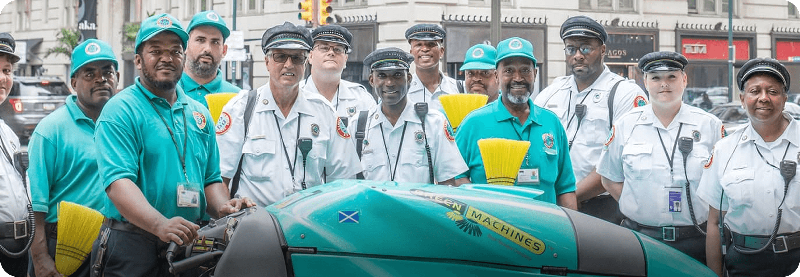
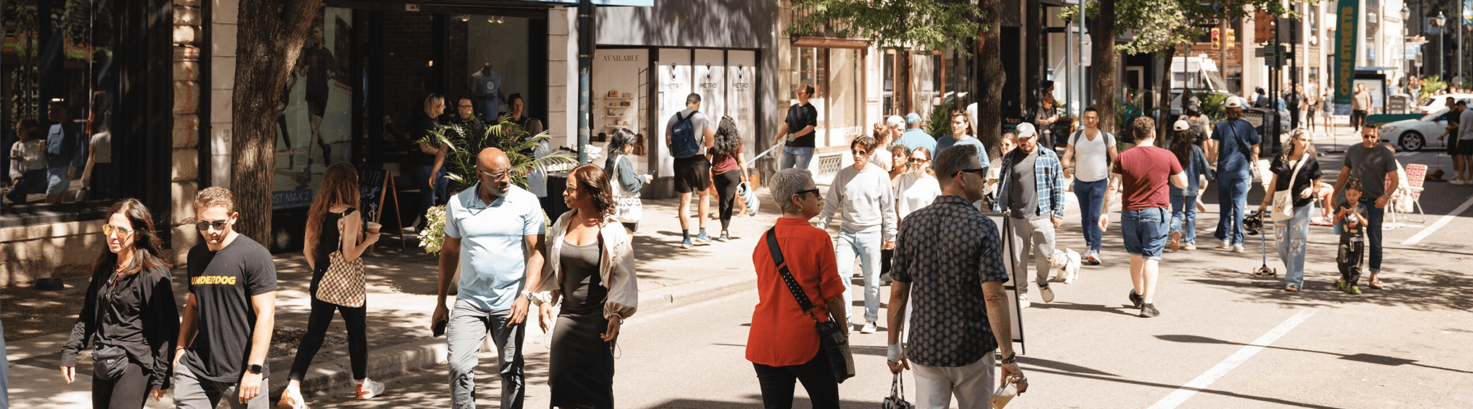
Across Center City Philadelphia, cleaning crews, Community Service Representatives (CSRs), public-safety teams, and outreach staff are in motion every day. Their work ranges from removing graffiti and addressing sidewalk issues to helping visitors, checking on businesses, and supporting people experiencing homelessness. The information behind that work matters just as much as the work itself: managers need to know what happened, where it happened, who is following up, and what the numbers show over time.
Center City District (CCD) has used District360 since 2023 to bring core field-service and case-management activity into a Salesforce-based operating environment. Rather than treating that initial rollout as the finish line, CCD and the District360 team have continued refining the system around what staff actually encounter on the street: more reliable counts, cleaner case data, location-based visibility, and practical workflows for different teams. The result is not a single dramatic cutover. It is an ongoing shift from capturing activity to making that activity more usable for supervisors, operations leaders, and the people responsible for serving downtown.
Center City District
Give field teams an accessible way to record day-to-day activity while giving CCD managers trustworthy, location-aware data they can use to improve operations.
A District360/Salesforce case-management foundation connected to the District360 Streets mobile app; operational workflows across CSR, cleaning, and public-safety teams; geofenced and property-linked reporting; targeted field and data enhancements; and ongoing platform support.
Teams can capture structured field records and managers can work with a consistent operational history. Recent enhancements made syringe and graffiti reporting more precise, including a historical syringe-data update rather than leaving older records out of step with new ones.
The Situation
Across its 233-block service area and 46 miles of downtown sidewalks, CCD coordinates teams working in parks, near businesses, and throughout public spaces. Its field-service application already supported daily case reporting, and the organization had invested in location-based operational visibility. But CCD's 2026 onsite discussions exposed a familiar challenge for established systems: the core platform was in place, while several important reporting and follow-up processes still depended on individual spreadsheets, manual interpretation, or staff knowledge.
For syringe pickups, staff could record an incident but had no dedicated quantity field; counts were entered inconsistently or handled in separate reporting steps. Historical syringe details lived in free-text case descriptions and required careful reconciliation before they could become reliable reporting data. Graffiti reporting likewise needed a specific count of tags, not just a record that an incident occurred.
Other gaps crossed departmental boundaries. Retail survey information originated in ArcGIS, CCD's geographic information system (GIS), while property and business records and operational case history needed to remain consistent in the CRM (Salesforce). CSR supervisors relied on older dashboards whose filters were easy to alter inadvertently. Sidewalk cleaning supervisors were still completing paper location checks, then transferring the results to spreadsheets. Streetscape issues were also tracked across District360, ArcGIS/Survey123, email, and Philadelphia's 311 system. With updates spread across these tools, staff had to piece together an issue's status and follow-up history.
The challenge was therefore not to start from zero or replace every other tool. It was to make CCD's existing systems work together more deliberately, without losing historical context or adding complexity for people in the field.
How We Built It Together
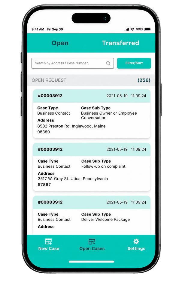
CCD's District360 Streets field-service app is organized around real operating scenarios, not a generic form. CSR staff record hospitality, safety, public-space, and business-contact activity: cases that need further attention can remain open for follow-up, while routine interactions can be recorded and closed. The Salesforce side gives managers a way to review cases, related locations and properties, and team activity. This workflow-first foundation has been part of the CCD rollout since 2023, and continued discussions in 2025 and 2026 focused on removing unnecessary clicks and preserving practical field behavior.
In August 2026, the District360 team deployed a dedicated "Number of Syringes" field in the Safety & Security → Syringe Pickup workflow. Field users could enter a quantity directly instead of relying only on narrative descriptions. CCD and the District360 team then reviewed historical cases and completed a production backfill, bringing earlier syringe data into the new structure. A "Number of Tags" enhancement for graffiti reporting was also confirmed complete in October.
These were focused configuration changes, but they addressed a larger reporting principle: a record that a cleanup occurred is not the same as a reliable count of what was removed. Structured values create a more consistent basis for analysis and trend reporting, while historical reconciliation protects continuity with earlier work.
For CCD, location is not an optional extra. Service areas, routes, properties, nearby addresses, and geofenced views shape how field activity is understood. CCD uses ArcGIS, its geographic information system (GIS) tool, for retail field surveys and hotspot mapping, while District360 supports operational case and property visibility. Rather than forcing a replacement of its GIS tools, the ongoing approach has been to preserve the right data relationships and make the handoffs more reliable. The same principle guides the recurring property and business imports: review mappings, identifiers, and historical relationships before loading new survey data.
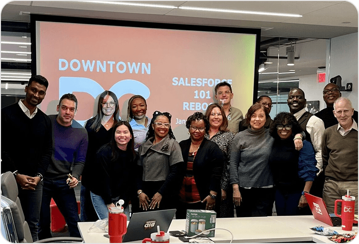
A June 2026 onsite engagement brought District360's team together with CCD stakeholders in reporting, cleaning, outreach, public safety, and parks. Those conversations focused on what managers could already see, which manual steps remained, and what a useful next-level dashboard or workflow would actually need to measure. The discussions led to a prioritized roadmap rather than a blanket promise to replace everything at once.
In October 2026, CCD and District360 renewed their relationship under a managed-support model. That creates a regular structure for reviewing priorities, carrying out platform maintenance, refining requirements, testing changes, and planning the next releases. It reflects a partnership built around the evolving operational needs of a long-running downtown system.
The Impact
CCD can already use its District360 environment to record operational activity and connect cases to relevant places and workflows. The 2026 field and data improvements add an important layer of precision. Instead of treating syringe and graffiti activity as a yes-or-no event, CCD can capture useful counts. By reconciling earlier syringe cases, the team avoided creating a clean data structure only for new activity while leaving historical records behind.
What the team can do now:
What's next
CCD and District360 are now prioritizing a set of enhancements shaped by frontline staff. Cleaning supervisors requested two separate tablet workflows: "Location Check," to replace repeated paper checks of cleaners by quadrant and route, and "Dilworth Park," to record area-specific cleaning tasks one at a time.
The outreach team is also defining in-system tracking for mental-health intervention cases, including court-hearing outcomes, and a more structured way to record repeat homeless/panhandler interactions. The objective is better internal follow-up and demographic reporting, without collecting client photographs. On the streetscape side, the next challenge is shared visibility across CCD, ArcGIS/Survey123, email, and 311. The proposed direction is to help staff recognize when an issue has already been reported, retain its external communication history, and avoid repeating the same request unnecessarily. September retail survey data mapping and the related property/business import are also being reviewed as part of the ongoing data-quality program.
Across these initiatives, the goal is consistent: capture information once where practical, keep it accurate, and make it accessible to the teams responsible for follow-up. New capabilities can then build on workflows that have been tested with the people using them.
CCD's experience shows that digital transformation does not end at launch. By refining mobile workflows, preserving historical data, and keeping location context connected to operational records, CCD and District360 are building a stronger foundation for the work ahead.
No. CCD uses ArcGIS for field survey and geographic analysis alongside District360/Salesforce for operational records and reporting. Integration and handoff design should match the district’s existing processes, rather than assume one tool must replace the other.
Yes. CCD’s 2026 enhancements added dedicated count fields, reconciled historical data, and maintained the existing operating environment. Larger workflow changes are separately scoped and tested rather than being conflated with routine maintenance.
Start with consistent fields and definitions, preserve location and case relationships, and agree on which measures support decisions. CCD’s reporting discussions distinguish activity counts, cleaning volumes, service outcomes, and executive dashboard needs- each requires the right underlying data.
CCD and District360 can validate measures such as volume of completed field submissions, completeness of quantity fields, turnaround time for follow-up cases, supervisor-check coverage, and time spent preparing recurring reports. Baselines and outcomes should be agreed with CCD before they are published as impact metrics.
Four field teams, one platform, and District360 Streets helping the district nearly triple cases handled per shift.
Nearly a decade of building one connected platform for service requests, field operations, and board governance.

A Philadelphia district moving its operations off scattered spreadsheets and onto District360.
Let’s talk about your teams, your workflows, and what one platform could look like for you.